When i am writing this, i just grew older by 1200 kms..
having completed the trip to Shirdi :)
Although lot many travel options are available, i chose to cruise;
Yaa, the odds were against:
Highways not in great shape, peers sharing road are those huge & lazy trucks;
Anyways the itch to drive is compelling & cure for itch is to roll the steer & head on for that long drive :)
Few Quick facts on Hyderabad to Shirdi Route
- The route we used: Hyderabad -> Sholapur -> Tembhurni -> Ahmednagar -> Shirdi. Based on opinion from Online community, this 607 km route seems to be safest for travelling with family. Although lot of truck traffic in this stretch, other way of looking at is: help is always available at times of need.
- Click this link to view the route in Google map
 |
| Route Map from Hyderabad to Shirdi |
- Total Journey time: 12 Hours, that includes 1 hour of R & R
- Total Fuel Consumption : 100 ltr including to & fro Journey
- Mileage: 12.83 kmpl (Conditions: 1500 CC Engine, 3 Passenger, Continuous A/C running at 40% setting, Luggage)
- 8 toll gates between Hyderabad to Shirdi & sum of all toll amount is Rs 135
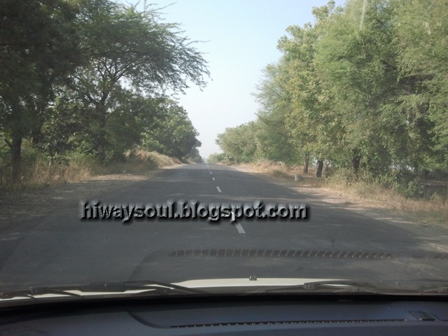
- Initial 40 km of Hyderabad to Sholapur route is 4 lane with divider. Rest of the route is 2 lane with no divider
- Road condition between Hyderabad to Sholapur is good, with speeds you can reach up to 140 kmph
 |
| Hyderabad to Sholapur Road Condition |
 |
| Hyderabad to Sholapur Road Condition |
- Occasionally Trucks will be sharing the road space with you. Track for this Stretch is Tiesto's Album Elements of Life ;)
- Be Very cautious about two wheeler drivers, most of them ply without road sense; Usually they appear in mid of the road from anywhere and can take a erratic turn very casually. Drive with ALL EYES ON ROAD
 |
| Hyderabad to Sholapur Road Condition |
 |
| Hyderabad to Sholapur Road Condition |
- Once reaching Sholapur, truck traffic increases phenomenally.
- Road expansion work is going on at Sholapur - NH9 bypass, so the available space is quite narrow
 |
| Sholapur Bypass Road (NH9) |
 |
| Sholapur Bypass Road (NH9) |
 |
| Sholapur Bypass Road (NH9) |
- Just after few kms from Sholapur, you could find lot many dhabas on your left. But they are open only for lunch & dinner.
 |
| Hotel Jungli, Nice Place for stopover @ NH9, Sholapur to Tembhurni |
- From Sholapur till Tembhurni in NH9, the road condition is so worse & narrow that even at speeds of 80 kmph, you will feel like travelling inside a roller coaster. I would say this is the worst stretch in the entire Hyderabad to Shirdi route
 |
| NH9 Road Condition, Sholapur to Tembhurni |
 |
| NH9 Road Condition, Sholapur to Tembhurni. Truck Traffic can be seen in picture |
- Patience is the key, while traversing this stretch. Better to hear RD Burman or some meditation music but ensure you don't fall asleep :)
 |
| NH9 Road Condition, Sholapur to Tembhurni |
 |
| NH9 Road Condition, Sholapur to Tembhurni. Live with Trucks :) |
 |
| NH9 Road Condition, Sholapur to Tembhurni |
 |
| NH9 Road Condition, Sholapur to Tembhurni |
- Your peer group in this stretch will be bullock carts carrying sugar cane :) They go in a line of 10 to 20 carts, moving slowly and blocking the road. Just enjoy watching those humble bulls marching peacefully, coz you got no other choice until you over take them :)
 |
NH9 Road Condition, Sholapur to Tembhurni
 |
| NH9 Road Condition, Sholapur to Tembhurni. Bullock Carts carrying Cane |
|
- Travelers driving to Malshej Ghat via Pune, take diversion by clicking this link < http://hiwaysoul.blogspot.in/2012/07/trip-to-malshej-ghat-maharastra.html#TravellerstoPune>
- Travelers driving to Shirdi via Ahmed Nagar can continue reading.
- The road condition is better between Tembhurni and Ahmednagar. You can safely achieve max speeds up to 140 kmph
- Anyways, be wary about number of steep turns in this stretch, with couple of them having no sign boards.
 |
| Fuel Station located after Right cut from Tembhurni. 402 km from Hyderabad |
 |
| SH141 Road condition, Tembhurni to Ahmed Nagar |
 |
| SH141 Road condition, Tembhurni to Ahmed Nagar |
- Occasionally trucks ply in this stretch
 |
| SH141 Road condition, Tembhurni to Ahmed Nagar |
 |
| SH141 Road condition, Tembhurni to Ahmed Nagar |
 |
| SH141 Road condition, Tembhurni to Ahmed Nagar |
- You can find good places to stop over to taste a piece of sugar cane in this stretch
- From Ahmednagar to Shirdi, the road is fantastic with 4 lanes & dividers.
 |
| Ahmednagar to Shirdi Road Condition |
 |
| Ahmednagar to Shirdi Road Condition |
|
 |
| Ahmednagar to Shirdi Road Condition |
|
- Anyways trucks are unavoidable in this stretch too, but by this time you would have developed a liking towards trucks :)
- This dream run will continue till Kolhar Budrukh, a place 30 kms from Shirdi. Then there is a narrow bridge over River Pravara, on which all trucks, bullock carts, tractors & cars have to traverse. Think you are lucky, if you had crossed this zone in 30 minutes :)
 |
| Traffic Blockade near Pravara River Bridge, Ahmednagar to Shirdi |
 |
| Traffic Blockade near Pravara River Bridge, Ahmednagar to Shirdi |
|
 |
| Traffic Blockade near Pravara River Bridge, Ahmednagar to Shirdi |
|
 |
| River Pravara |
- Then the road condition till Shirdi is not that great, with potholes and uneven tar spills. After tough man oeuvre you will reach the divine town.
- Most of the establishments in Shirdi, has the God's name SAI associated. So if your hotel landmark also reads SAI, think again. Get more landmark info for the hotel you are planning to stay. It helps you locate the place quickly, especially after that tiresome drive
- Petrol Bunks are available at regular & frequent intervals, all through the Hyderabad to Shirdi Route.
- Anyways there are few exceptions, that is provided in the picture below. Click this link to view the same in Google maps
 |
| Frequency of Petrol Bunks in Hyderabad to Shirdi Route |
Credits & Acknowledgement to my friend for jotting down information on Petrol Bunks enroute and Clicking nice pics about road condition
Below table provides details on places of Interest like Petrol bunks, Hotels, Rest rooms that we observed enroute.

Info on Road Condition in Return Journey
Our return route: Shirdi - > Shani Shingnapur -> Ahmednagar.
From Ahmednagar to Hyderabad we used the onward route
 |
| Shirdi (A) to Shani Shingnapur (B) to Ahmednagar (C) |
When we headed to Shani Shingnapur from Shirdi, we again got struck at River Pravara bridge. But once crossing the bridge, the road ahead is clear of traffic.
 |
| Traffic Blockade near Pravara River Bridge, during return trip also |
 |
| Traffic Blockade near Pravara River Bridge |
 |
| Traffic Blockade near Pravara River Bridge |
 |
| Traffic Blockade near Pravara River Bridge |
 |
| Traffic Blockade near Pravara River Bridge. Trucks carrying Sugar cane |
After 50 km travel in SH10, took the left turn. Clear signboard available at your left, indicating the direction towards Shani Shingnapur. The road is quite narrow with frequent bad patches.
 |
| Condition of Road to Shani Shingnapur |
While traversing this stretch, be prepared for unexpected guests knocking your car window. Don't get surprised, if some guy in bike does the same. When you roll down the window, he may enquire if you have come for the temple & then he would give his shop visiting card. He will also request you to visit his shop to buy pooja items for darshan; all these things happening in motion.
 |
| Condition of Road to Shani Shingnapur |
|
 |
| Condition of Road to Shani Shingnapur |
|
 |
| Condition of Road to Shani Shingnapur |
|
As soon as you reach Shani Shingnapur toll gate, you may be greeted by group of well wishers :) requesting you to use the free car park located @ short distance from toll booth; which really seems to be a genuine piece of advise. But the actual intention behind is, those well wishers have their shops located in the free parking lot. So their chances of getting customers increases, if you park the car here.
Actually, this free car park is total mess. Buses, cars and vans parked randomly. While there is some one to force you inside the car parking area, there is nobody coordinating vehicles that are trying to come out. You may face a tough time getting your car out of this parking lot.
So, better skip this parking lot and use the one few meters next to it. This is a paid parking lot, which i observed to be quite organised than the previous one. The sign board @ paid parking read, Rs 20 for car.
From Shirdi, we traveled to Ahmednagar through SH 44. The stretch from Shani Shingnapur to Ahmednagar is quite Scenic (B to C in the map).
 |
| Shani Shingnapur to Ahmed Nagar, SH 44 Road condition |
 |
| Shani Shingnapur to Ahmed Nagar, SH 44 Road condition |
There is Cafe Coffee day restaurant enroute. Good place to chill out in mid of drive.
 |
| CCD in the scenic spot at SH 44, Shani Shingnapur to Ahmed Nagar |
Click this link to locate this CCD in google map
 |
| CCD in the scenic spot at SH 44 |
 |
| CCD in the scenic spot at SH 44 |
Lot of parking space available. The service in CCD is good.
 |
| CCD in the scenic spot at SH 44 |
 |
| CCD in the scenic spot at SH 44 |
 |
| Restaurant in the scenic spot at SH 44 |
 |
| Restaurant in the scenic spot at SH 44 |
 |
| Shani Shingnapur to Ahmednagar, SH44 |
From Ahmednagar to Hyderabad, we traveled via the same onward route.
We noticed this petrol bunk, had rest rooms & air pressure check facility. This bunk is located 104 kms from Ahmednagar in SH44.
 |
| Petrol Bunk at Ahmednagar to Tembhurni |
 |
| Petrol Bunk at Ahmednagar to Tembhurni |
 |
| Petrol Bunk at Ahmednagar to Tembhurni. This bunk has tire pressure check facility |
 |
| Railway gate near Jeur, Ahmednagar to Tembhurni Road condition, SH 141 |
 |
| Sholapur to Hyderabad Road conditon |
 |
| Sholapur to Hyderabad Road conditon |
|
 |
| Sholapur to Hyderabad Road conditon |
|
 |
| Sholapur to Hyderabad , Naldurg Fort |
|
 |
| Market, Sholapur to Hyderabad |
 |
| Market, Sholapur to Hyderabad |
PND Vs Smartphone Navigation (GPS)
This trip, i tried to find some answers for the much debated topic "PND Vs Smartphone Navigation".
Like any other gadget lovers, i had this question always creeping in my head.
Do we need a dedicated PND (Personal Navigation Device) for navigation or all in one Smartphone is enough for doing the job?
So i decided to put my PND & Smartphone to compete each other.
Oh, ya, before moving on, we gotta compare if the guys put to fight have equal powers.
Let us make a quick check on device configurations.
- PND is Magnum make, loaded with Satnav Maps displayed in 12.7cm screen, powered by Sirf Atlas IV Chip, 600 Mhz Processor and 1450mAH Lithium Battery. The device Geo positions itself by communicating with satellites
- Smartphone is a Samsung SPlus, navigates using Google maps, powered by 1.4Ghz Processor & 1650mAH battery. This gotta a nice AMOLED 4" screen. The device positions itself using location info from cell network towers.
Comparing config, it sounds like we got guys with real muscle to compete each other :) Let us see who can navigate us safely to the destination.
 |
| The Battle ground :) PND Vs Smartphone Navigation |
It was 5:30am of a winter day when we started. The morning chill tries its best to freeze us. Quickly tucked up ourselves inside the warmth of car cabin. Fed the destination location in the PND. GPS lock with satellite happens in 10 seconds.
On the other hand, the smartphone was trying to load its navigation maps... Loading... Loading.. The connection is 2G, but that day it was unusually slow in loading... Still Loading..Having waited for couple of minutes, we had no further patience. Kicked off our journey with only PND guiding us.
Everyone deserves a second chance. Don't we? The smartphone navigation was given a second chance to compete with the PND, after we had traveled around 100 kms. May be knowing that was its last chance to prove itself, the smartphone locked up the GPS signal in less than 5 seconds & showed the navigation path, distance remaining etc.
Everything went fine for the next 10 minutes. Oh, then that happened.. The smartphone screen blacked out for power saving :) OMG :) With one hand how to bring the screen back to life?? The smartphone navigation has withdrawn from the field, before even the battle had started. LOL.The PND was grinning already :)
Seems like SPlus has got the maximum display time for 10 minutes. Otherwise can't figure out how to keep the screen alive always. May be during the next trip, i may download some dedicated android navigation software that can address these issues.
Anyways, let me share my experiences while comparing PND Vs Smart Phone Navigation in this trip:
- The smartphone uses A-GPS for positioning, that means it needs network availability. In places where there is no network, you are on your own. We observed some places near Naldurg, Shani Signapur where the Smartphone din't show proper location. For example, when we were 6km away from the right turn to reach Ahmed nagar, the smartphone navigation shows we got still 30 km left for the same right turn. LOL :)
- The PND directly communicates with Satellites;
- So the good news is, which ever part of the world you are driving, there are some satellites to help you navigate.
- The bad news is the GPS signal reception needs a clear sky view and the only solid it can penetrate is glass. So if you are inside a long tunnel or parking cellar you may not get GPS support. But anyways as long you are not going to stay there perennially, you will get the satellite connection once you come outside.
- For the same reason, it is suggested to mount the PND device in the front window of the car, so that the GPS receiver gets a clear view of sky.
- In my experience, i have got continuous satellite connection & GPS support in spite of driving in heavy down pours and cloudy conditions.
- Looking at the picture, one can compare where a smartphone, even like Samsung S Plus stands against a less expensive PND in terms of navigation display & screen size. The display in PND is optimized for navigation in terms of font size, power consumption. The smartphone with google maps, even with larger font setting is some what cumbersome to read; that means person behind the wheels has to pay more attention on the device rather on the roads.
- And with that rich AMOLED display & fantastic contrast it consumes more power than the dull looking PND screen, which is just designed to meet the requirement. More power consumption means you gonna burn more fuel to recharge your phone battery. Neverthless to mention, with GPS option switched ON the phone goes madly hungry & feeds voraciously on the power back up.
- Here another point to note is, the PND also needs to be charged during drive, but the power consumption can be low as the display is quite dull and it directly communicates with satellites using radio signals. With full charge on PND, the device runs for an hour without any power supply.
- Regarding the investment cost, the PND costed me 14.5K & SPlus costed 22.3K. Other than power consumption, the running cost of PND is almost nil. Generally i used to go for a yearly map upgrade, which costs 450 bucks & i got this free as it was 1st year subscription. For the smartphone, data charges are applicable for downloading maps and triangulation details from network. I had subscribed for Rs 99 pack for 2GB data per month, that comes quite handy for me. So this would be the running charges for smartphone.
- The best part in Google navigation is its flexibility and variety of details it provides. Information on petrol bunks, ATMs, Restaurants located on the highway are very much available in Google maps. The info are sought as a boon for a traveler en route. In my opinion, the map providers for the PND have a long way to go. As of now, the maps loaded in PND provides the so called Places of Interest (POI) for cities. But it lacks details on Petrol bunks etc located on highways between the cities. The highways, inter connecting roads are anyways part of the maps, so you wont have trouble navigating.
In my view, a PND that packs maps loaded with lots details & flexibility in choosing routes similar to Google maps would be a hot product; would sell like like hot cake; with me first in the queue to buy it :)